|
The
ancient times around one million ago, Taichung area consisted of Dajia River
and Dadu River. The "United Alluvial Fan" where the gravels of the
Hsuehshan Mountains were scrubbed down, piled
up day by day and became Taichung Basin afterwards. 700 thousand years ago,
while Chelongpu was proceeding the active fault, the
western Bagua and Dadu tableland were risen up and then became the landform
of basin. Dajia River's old river course becomes Fozih River today. Until
Dajia River's old alluvial fan (Fengyuan Alluvial Fan) was piled higher than
Dadu Tableland's and Houli Tableland's saddles, Dajia River started to flow westward
and then flew down close to Dajia River's old alluvial fan to lead to Today's
"River Terraces" of Dajia River. It also caused the old Taichung
area to pile up the gravels from 45 to 150 meters high and led the river
courses to spread around and the river bed was
filled with gravels. Until now, no matter where you dig in Taichung, you will
dig out a thick gravel, which is the evidence. The
orogeny throughout 500~600 thousand years induced the earth predecessor,
adding the rising of the eastern basin, so it formed the lower hills in
Taichung Basin, namely Today's Mt.Touke stratum.
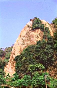
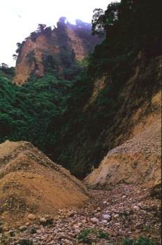
Dakeng Scenic Area consists
of Touke Mountain to Erke Mountain. Mt.Touke stratum is mainly based on
sandstones and shales. Sandstones are coarse and hard and shales are soft
with small particles. Both of their powers to resist erosion are markedly
different. Mt.Touke has the strong geology of collapse, which is firstly
observed among the worse landforms. Owing to the orogeny of glacial epoch
twice, it caused the local mountains steep. Rare people develop there, so
Mt.Touke keeps its original shape and cultivates local plentiful natural resources.
|